 Sereno Routing guide
5. Reports
A PDF to read or print, CSV for a spreadsheet, GPX for a plotter, and the planner's passage brief.
The route PDF
Tap PDF in the route's bar and choose a model, or use Download PDF on the Export tab. There's one PDF per model. The router builds it, which takes a little while, and your browser downloads it. Times print in your device's time zone.
It holds:
- A box on page one for each thing to know before the rest: the route is partial, has depth warnings, runs on climatology past the forecast, or passes near an indicated upper air disturbance or an official storm (see Storm and disturbance notes). Then the contents, linked to each section.
- The chart: the track colored by tack and motor, the start, finish and waypoints, and arrows for the current.
- The passage: departure, arrival, duration, distance, average speed, hours under sail, under motor and at night, tacks and gybes.
- Conditions along the way: true and apparent wind, gusts, boat speed, the highest waves and steepest seas, the comfort split, legs over a limit and the current, with bars for wind angle and wind speed.
- What was asked for: the polar, the forecast run, the sailing angles, the motor, the polar by day and at night, the boat comfort was rated for, land clearance, minimum depth, reefs and avoid areas.
- The weather data: the checks the forecast passed before it was used.
- Leg by leg: a row per leg with time, speed, course, current, wind, waves, sail, action and comfort, with the comfort's reason under each row. Legs with depth warnings are shaded.
After the legs come the passage brief's pages, worked out along this route's own track and times:
- Day by day: each day at sea, with a line for any upper air disturbance near the track that day, the weaker signs included.
- Ensemble spread: how far the ensembles spread on the wind along the track and on the arrival time.
- Upper air: each day's squall risk and what the models' upper air shows, with the source and run of each model.
- Along the track: charts of each model's conditions against time, current included, with the ensembles' 10th to 90th percentile wind shaded behind them where it's held.
- The sea: wave height and period, and how steep the sea is.
- Official forecast: where one is set up (Fiji so far).
- How this was made: the sources, the rules every sentence follows, and the credits.
Wave heights and wave limits print in meters or feet, as your Units setting asks (on the Android app, its Display setting).
CSV and GPX
On the Data face, open Export.
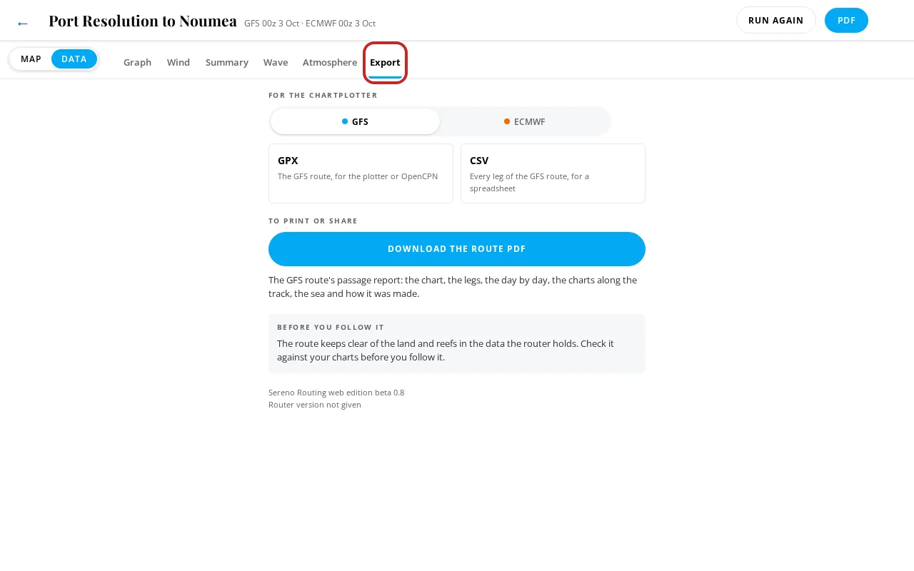
- Download CSV: the full leg table, a column per value, for a spreadsheet.
- Download GPX: the route as a GPX route for a chart plotter or navigation app. It holds the departure, the arrival, your waypoints, and a point at each turn of more than 20 degrees, each with its planned time, speed and wind in the description. The Android app lets you set the turn angle (0 keeps every leg).
A GPX route from here is a plan from a forecast. Before you follow any of it, check every leg against your charts, especially near land and reef.
On the Android app, the Export tab has Share GPX, Share CSV and one Download GFS PDF button per model. Files are saved to Downloads and offered to the share sheet.
The passage brief
With Routing and planning on, each screened departure day has a passage brief: a longer PDF about the weather for that day's passage, built from the ensembles as well as the three models. Open it with Open brief on the day (see One day) or on the Watching page. The first brief in an area takes a few minutes; later ones take seconds. When it's ready, choose Open PDF or Save PDF.
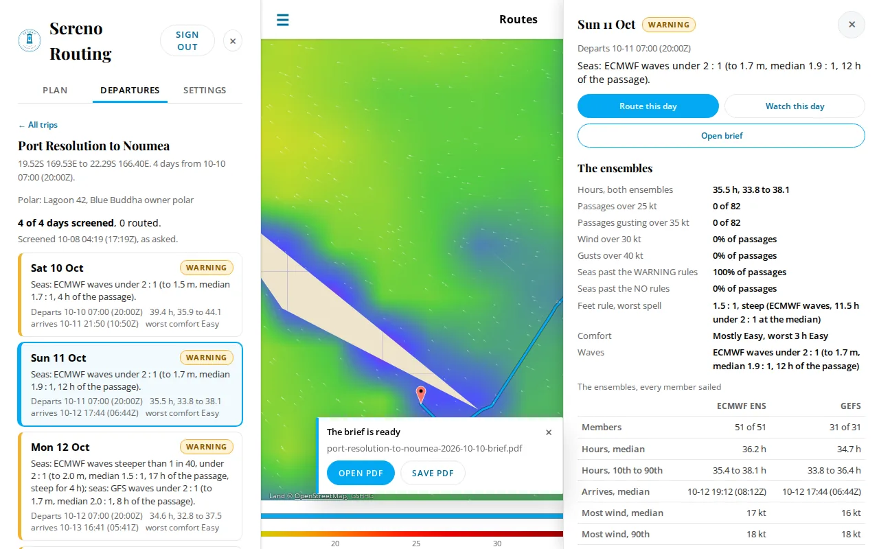
It holds:
- Trip estimates: hours at sea, arrival, distance, average speed, point of sail, current, comfort and fuel, for your polar and for a conservative 80% of it, from every ensemble member.
- Day by day: each day at sea: wind, gusts, direction, waves, boat speed, current, distance, motor hours and comfort.
- The sea: wave height and period, and how steep the sea is.
- The weather story: the weather along the way, with the squall risk (low, isolated, moderate or high), and the note for any indicated upper air disturbance or official storm near the passage, the weaker signs' line under it, and the centers' credits (see Storms and disturbances on a day).
- Along the track: charts of the conditions along the path.
- Official forecast: where one is set up (Fiji so far).
- How this was made: the sources and the method, including the rule that indicates an upper air disturbance.
Wave heights print in meters or feet, as your units setting asks.
A route made from a planner day has a Brief tab, on the web and on the Android app, with Download brief PDF. On the web, its Upper air disturbance and Tropical cyclones cards carry the same notes.